Sunday, August 12, 2012 - I found two Virtuals and nine
Traditional Caches today and no DNFs. I found caches on DELORME Atlas pages 70, 71, 64, 84 and 85. At the first cache - the Stukel Ranch marker - I was attacked by hundreds of hungry mosquitoes.
The Lost River Gap and Ford was a very interesting site. The Text Marker read:
Used by Indians; by Hudson's Bay trappers; by covered wagons; by Fremont 1846; by railroad survey party 1855; by soldiers at Fort Klamath. Site of the Modoc Indian conference in hope of averting war with that tribe; of the first water wheel; of the first fish cannery in the Klamath Country; of stage stops and of roads.
I encountered dense smoke as I drove toward Lakeview. The smoke came from the Barry Point fire
straddling the Oregon-California border where
it is burning timber and sagebrush on the Modoc National Forest. The fire is one of four major blazes still
burning across Oregon since a series of lightning storms last week. The weather
remained hot and dry.
Lakeview is the "Tallest town in Oregon," standing at 4,800 feet. There was a fire staging area at the Fairground in Lakeview.
I did a series of "breadcrumb"
caches on the way east. I took a couple photos in Adel and then backtracked on Hwy 140 to just north of Lakeview where I headed northwest to La Pine on Hwy 31.
I stopped at Chandler State Wayside,
a
state park 16 miles north of Lakeview.
Somewhat unusual for this part of Oregon, it is covered in large
Ponderosa Pine. The picnic area is near
Crooked Creek. The wayside offers an
excellent view of Albert Rim which is approximately two miles to the east of
the wayside. I missed seeing the view probably
because of the heavy smoke from the forest fires.
Marker Text: Having been
among the early pioneers in this area S.B. Chandler became one of the largest
land owners in the vicinity during that era (1870 - 1930). He ran large amounts
of sheep and also some cattle. This
property was donated to the Oregon State Highway Department for use as a park
in July 1929 by S.B. and Mattie Chandler [and named in their honor].

Big mistake not to fill up the car with gas in Lakeview. Gas station are evidently not open on Sunday in the heartland. I stopped at Paisley with a quarter tank of gas and many miles to go.
Paisley is a small town located along Oregon Route 31, between Summer Lake and Lake Abert. The population was 247 at the 2000 census. I had lunch at the Pioneer Saloon at Paisley. I ordered a BBQ sandwich with fries and got tater tots! The two-pump Chewacan
(which means little potato) Garage was luckily open so I got $20.00 of gas.
I stopped at Silver Lake Cemetery. A large monument in the cemetery is a grim reminder of one of the worst fire disasters in the State of Oregon. The monument bears the names of 43 persons who lost their lives on Christmas Eve in 1894. Every family in the area was touched by the tragedy.
I stayed the night at the Quality Inn in Bend. I purchased some items at a nearby Quik Mart for "dinner" which I ate in my room, watching television.


 I stopped at Chandler State Wayside, a
state park 16 miles north of Lakeview.
Somewhat unusual for this part of Oregon, it is covered in large
Ponderosa Pine. The picnic area is near
Crooked Creek. The wayside offers an
excellent view of Albert Rim which is approximately two miles to the east of
the wayside. I missed seeing the view probably
because of the heavy smoke from the forest fires.
I stopped at Chandler State Wayside, a
state park 16 miles north of Lakeview.
Somewhat unusual for this part of Oregon, it is covered in large
Ponderosa Pine. The picnic area is near
Crooked Creek. The wayside offers an
excellent view of Albert Rim which is approximately two miles to the east of
the wayside. I missed seeing the view probably
because of the heavy smoke from the forest fires.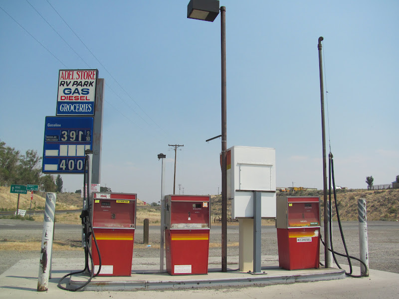


No comments:
Post a Comment